See the world as data.
Understand it as intelligence.
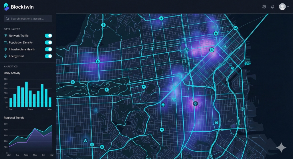
Block transforms raw geospatial data into clear, actionable insights — without the complexity of 3D systems.
The problem with geospatial data
today
Too many fragmented sources
Organizations struggle to consolidate satellite imagery, GPS data, and public datasets into one coherent view.
Complex tools for simple questions
Heavy 3D platforms and GIS software create barriers when teams just need clear, 2D spatial insights.
Insights buried in complexity
Critical patterns remain hidden in dashboards designed for technical specialists, not decision-makers.
Meet Block
Block is Atlas's 2D geospatial mapping platform that makes spatial intelligence accessible, powerful, and purpose-built for real-world decisions.
Simple 2D Mapping
Visualize geographic data through intuitive, high-resolution 2D maps that anyone can understand.
AI-Powered Insights
Advanced machine learning automatically extracts patterns, predicts trends, and surfaces actionable intelligence.
Data Fusion
Seamlessly integrate diverse geospatial sources — satellite imagery, IoT sensors, public datasets.
Collaborative by Design
Cloud-based infrastructure enables real-time collaboration for team analysis and decisions.
What Block helps you achieve
Faster Decisions
Make confident decisions backed by real-time spatial intelligence.
Lower Costs
Reduce operational expenses by automating geospatial analysis tasks.
Predictive Power
Forecast scenarios from traffic patterns to risks before they happen.
Democratized Insights
Empower non-technical stakeholders with accessible spatial intelligence.
20+ Industries transformed by Block
Real Estate
Explore use case →
Agriculture
Explore use case →
Logistics
Explore use case →
Urban Planning
Explore use case →
Environment
Explore use case →
Tourism
Explore use case →
Insurance
Explore use case →
Retail
Explore use case →
Transportation
Explore use case →
Healthcare
Explore use case →
Energy
Explore use case →
Mining
Explore use case →
Construction
Explore use case →
Education
Explore use case →
Government
Explore use case →
Defense
Explore use case →
Entertainment
Explore use case →
E-commerce
Explore use case →
Finance
Explore use case →
Telecom
Explore use case →
How Block works
A simple, powerful workflow that turns raw data into strategic decisions
Data Sources
Connect satellite imagery, GPS, IoT sensors, and public datasets
Block AI Engine
Automated processing, feature extraction, and pattern recognition
Interactive Maps
Clear, intuitive visualizations updated in real-time
Decisions
Actionable insights that drive strategic outcomes
Part of the Atlas Ecosystem
Block integrates seamlessly with Atlas's other platforms. Start with 2D mapping, then scale to 3D immersive environments or full digital twin simulations as your needs evolve.
Ready to see your geospatial data differently?
Join organizations using Block to make smarter, faster decisions with spatial intelligence.